

The makers of a new artificial intelligence-driven method for analysing drill cuttings from wells say it will revolutionise drilling success rates and inform project decisions.
Grain-e – launched by Simon Molyneux of Molyneux Advisors – uses AI to assist geologists' analysis of cutting samples, making it possible to automatically assess thousands of individual grains.
YOU MIGHT ALSO LIKE
Cuttings are stored as geological records of the wells and were previously analysed individually in a manual process. Molyneux said most companies and countries store the cuttings in bags for the long term because they have a "small but residual value."
Through Grain-e – which was named as a 2025 WA innovator of the year – images of the cuttings were transformed from something which was previously simply interesting into something which produces quantified data.
"We're liberating something," Molyneux said.
"This is not something AI is making more efficient; this is something AI is making possible."
Molyneux said Grain-e was "soft launched" to interested members of the industry about a year ago and he has since received positive feedback regarding the technology.
"We feel we've reached a level of technical maturity with the AI," he said.
"The 48 wells of data are out there and give a framework for the industry to work with, and we can then leverage off that in terms of the Grain-e technology.
"An Australian offshore operator has deployed the technology, and they have used it to make impactful decisions. I have received informal feedback that ‘this is great, we need to do more of this,' so that's very positive."
Idea's inception
Molyneux has been in the oil and gas industry for more than 25 years. After studying geoscience at university in the UK for six years, his first job was working at the Shell Technology Centre.
He said he worked on a project which required him to manually read through a report and take notes on the cavings - , which are tthe rock fragments gathered after a well is drilled.
"I'm working at Shell's technology. Surely, there's a better way of doing this," Molyneux remembered saying to his senior at the time.
"That sort of stayed with me and I thought: ‘Maybe this is the opportunity to change that game, and to do something that's a bit different, and alter some of the existing processes."
The digital twin technology was developed with Grain-e chief technology officer Alex Fuerst, who leads the dataset outputs and the technical development of digital workflows.
After sitting on the idea for many years and spending two years working on Grain-e with Freust, Molyneux found a way to efficiently analyse cuttings in a digital way, using AI to support human processes rather than replace it.
How it works
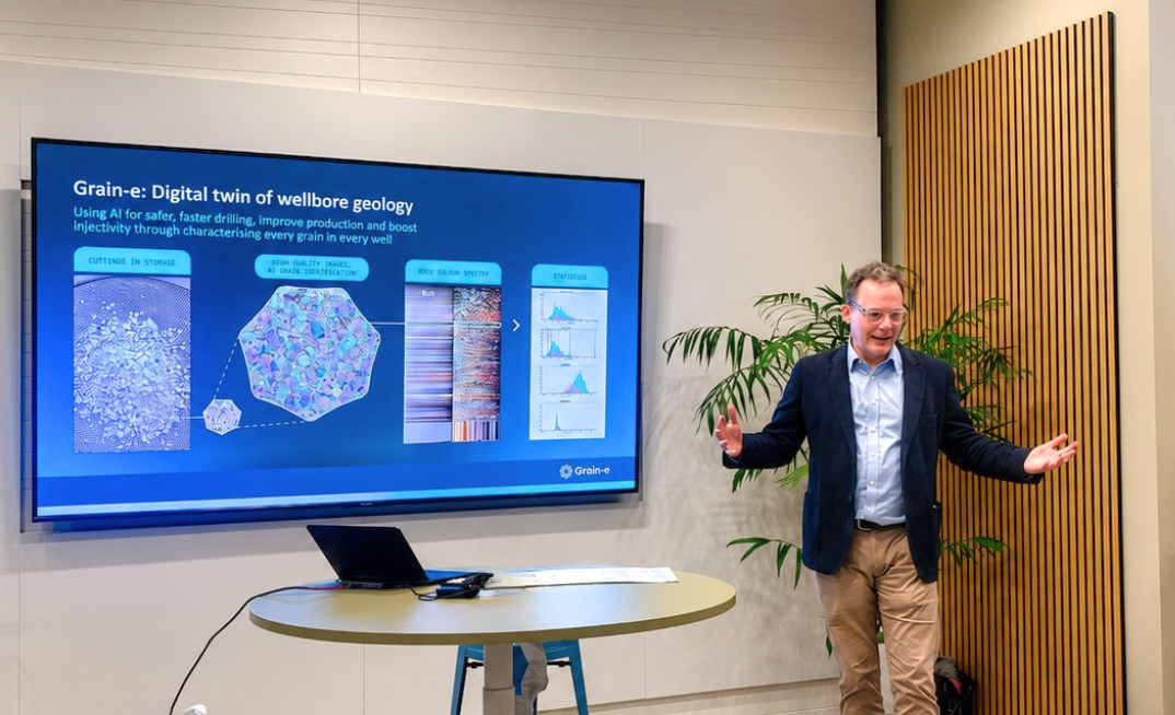
High-res images, AI and interactive filtering tools are combined to accurately analyse the grains in each drill cutting sample to provide data to geologists in a fraction of the time.
The data can then indicate the presence of hydrocarbons, indicating potential oil and gas reserves.
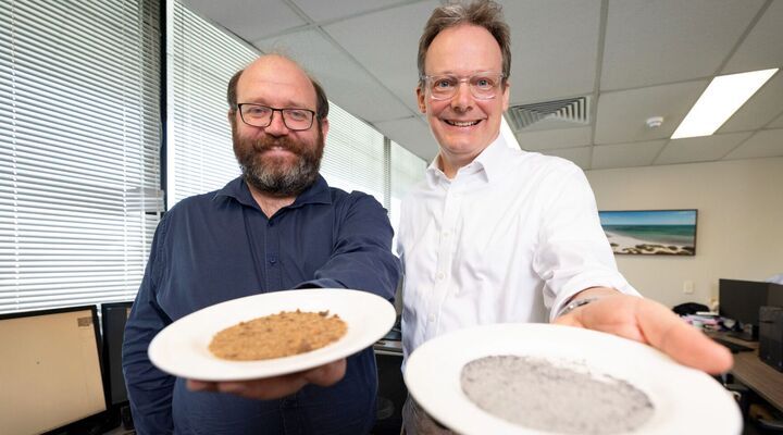
Rockwash Geodata director Doug Langton has been working with Molyneux for about three years.
With the help of Langton, the samples undergo a fully automated washing process before they are photographed under strict, controlled lighting conditions to capture fine details of the rock fragments at 4000 by 6000 pixels.
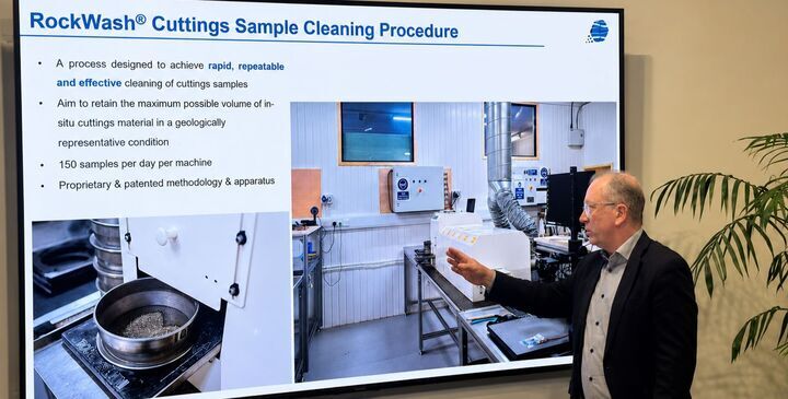
"We've taken something that was manual and written and made it digital, but with both AI and Doug's technology, it allows us to have the quality assurance, quality control," Molyneux said.
"We know every image is taken in the same way, and it's prepared in the same way. Everything to do with a particular AI technology, or anything to do with image recognition, is the input data of good quality or hygienic data.
"Some people think they can take pictures because they've got an iPhone, but that's not what we mean. The lighting has to be consistent and it has to be high quality."
Molyneux said a small shift in the colour of the images can indicate a real shift in the quality of the reservoirs in the subsurface of the wells, which geologists would not be able to see using traditional drilling plans.
"The real breakthrough lies in what happens next," he said.
"Using a proprietary trained segmentation model, we segment the image, identifying and outlining individual grains. This gives us a digital map of the grains in each sample. We then calculate properties like grain size, roundness, sphericity, and average colour for each grain.
"However, the process isn't perfect. Sometimes the model mistakes a bit of shale or paint for a grain or combines multiple grains into one. That's why we've developed an interactive filtering system that lets geologists review and refine the output.
"This ensures only representative grains are included in the final datasets."